


No Roads: Off Road Maps
3.521.00 Reviews
App Specs
- Version
- 1.9.3
- Updated On
- License
- Free
- Downloads
- 10,000+
- Developer
- i3 Product Development
- Categories
- Maps & Navigation
- Platform
- Android
Screenshots
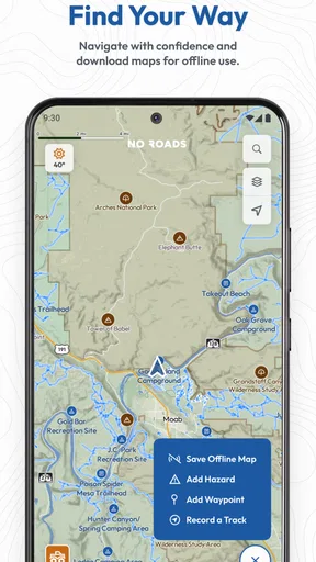
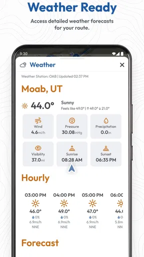
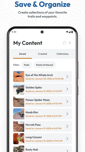
 Analysis by AppCompare
I approached No Roads: Off Road Maps as a practical navigation tool rather than a conventional road-mapping app. Its purpose is clear: help people discover and explore off-road trails, where a normal turn-by-turn map often stops being useful. That makes it interesting for drivers, riders, hikers, and anyone who prefers unpaved routes to ordinary streets, but it also means the app needs to be judged by different standards. The important questions are not only whether the screen looks clean, but whether the information is easy to use when you are planning a route, moving through unfamiliar terrain, or trying to recover from a wrong turn.
Developed by i3 Product Development, this free Maps & Navigation app is aimed at an Everyone audience and supports devices running Android 9 or later. It has reached over ten thousand installs, with a 3.5 average from around 55 ratings and 21 written reviews. Those figures suggest a small but real user base rather than a mature mainstream navigation platform. I would treat that as a reason to explore the app carefully before depending on it for a demanding trip, not as an automatic criticism. Off-road navigation is a specialized area, and a focused tool can be more useful than a famous road app when its map coverage matches the journey.
How No Roads feels during planning and navigation
I find the most useful way to judge No Roads during planning is to ask whether it helps me make a better decision before I reach a trail junction, rather than expecting it to remove uncertainty once I am already out there. I would check the wider network, note a sensible way back, and leave the detailed route choice until I know the day’s conditions. That planning mindset also makes trust and personal control important parts of the experience.
Speed expectations before leaving home
The first thing I noticed about a specialized trail app is that speed has two meanings. There is the speed of the interface, and there is the speed at which I can make a sensible decision. A map that opens quickly but leaves me unsure about the trail is not especially helpful. No Roads: Off Road Maps is most valuable when it reduces the time spent searching for suitable unpaved routes and examining the area before departure.
For casual planning, I would open it before packing the vehicle or deciding on a destination. That gives me a chance to inspect the available trail information without the pressure of moving through a remote area. A useful habit is to identify the main route first, then look for nearby alternatives instead of trying to build an ambitious trip immediately. This approach also makes it easier to notice whether the map offers enough detail for the particular region I want to visit.
I would not judge its performance by comparing it directly with a polished city-navigation app. Road apps are designed around frequent searches, traffic updates, address matching, and rapid recalculation. An off-road map has a narrower job. Its perceived speed depends heavily on how quickly I can recognize trail context and decide whether a route suits my vehicle, experience, and available time. That is why a calm planning workflow matters more here than flashy transitions or constant spoken directions.
One practical tip is to use the app as a route-discovery layer before using any other navigation tool for the approach to the trailhead. I can find the general area with a familiar road map, then switch attention to No Roads when the paved journey becomes secondary. This avoids forcing one app to handle two very different tasks and makes the specialized map easier to evaluate on its own terms.
Worth Reading Before You Choose

Flipboard Shows What News Apps Must Do Beyond the Feed

Switching to Android Auto Means Rethinking Your Driving Routine

Google Calendar Makes a Crowded Week Easier to Manage

Ludo King Makes the Most of the Minutes Between Plans

Baby Panda World Brings Quick Play to Modern Phones, but Its Game Library Feels Busy

ESPN’s Live Game View Makes Following Close Games Easier
What happens during heavy-use moments
The demanding moments are not necessarily the longest sessions. They are the moments when I repeatedly zoom, pan, inspect nearby paths, and compare possible exits. A trail ride can create exactly this kind of workload: I may need to check the next section, return to the wider map, and then examine a branch without losing my position. Any navigation app feels less comfortable when the user is doing all of that while moving, so I strongly prefer to make the decisions before starting.
A realistic everyday scenario would be a weekend driver reaching a trail network after a normal road trip. Before entering the unpaved section, I would stop safely, review the route in No Roads, and note the branches that could lead back toward the main road. If the chosen path becomes unsuitable, the useful action is not frantic screen tapping. It is to pause, regain orientation, and use the wider map view to choose a known alternative. The app can support that process, but it cannot replace judgment about weather, terrain, vehicle clearance, or local restrictions.
Heavy use also includes long periods with the map open while I am checking progress. I would keep the display interaction simple and avoid unnecessary exploration once the route is understood. That is not a special trick hidden behind a setting; it is a sensible way to reduce distraction and conserve the device during an outdoor trip. The more remote the destination, the more important it becomes to treat the phone as a limited tool rather than an unlimited source of guidance.
For riders and drivers who want to investigate many branches in one session, the app may feel more useful as a planning companion than as a complete expedition manager. Its store summary focuses on discovering and exploring off-road trails, and that focus is reflected in how I would use it: explore possibilities first, then commit to a route with realistic expectations. People looking for a highly automated navigation experience may prefer a broader platform with a stronger emphasis on live guidance and rerouting.
Reliability and recovering from a wrong turn
Reliability in off-road navigation is more complicated than simply asking whether the map loads. A trail can change, become inaccessible, or be unsuitable for a particular vehicle even when it remains visible on a map. I therefore see No Roads as an aid to orientation, not a guarantee that every marked route is currently passable. That distinction is essential for anyone heading into an unfamiliar area.
My preferred recovery workflow starts before the mistake happens. I would examine the surrounding network while stationary and remember at least one broad exit direction. If I take the wrong branch, I can stop, zoom out, and compare my position with the larger trail pattern instead of immediately reversing or making several random turns. This is one of the most useful ways to get value from an off-road map: it helps me understand the shape of the area, not merely follow a single line.
Another important habit is to leave extra time for uncertainty. A route that looks short on a screen may be slow because of surface conditions, obstacles, narrow sections, or repeated stops. No Roads can help with route awareness, but it does not remove those physical variables. I would never let a promising map view persuade me to continue into terrain that exceeds my vehicle or experience.
The app’s current version is 1.9.3, which indicates an actively identifiable release rather than an abandoned name, but a version number alone cannot promise flawless behavior on every device. My confidence would grow through repeated use in familiar areas: first compare the displayed trails with what I already know, then use it for a modest outing, and only later consider relying on it for a more isolated trip. That gradual approach is especially sensible because the overall rating sits at 3.5, showing a mixed reception rather than universal approval.
Device constraints and the cost of convenience
Because the minimum operating system is Android 9, the app is accessible to many older phones as well as newer models. That is helpful for users who keep an older handset in the vehicle or use a secondary device for outdoor navigation. Still, operating-system compatibility is only one part of the experience. Screen brightness, battery condition, storage, GPS behavior, and protection from heat or rain can matter more once the phone leaves the comfort of a home or car.
I would prepare the device before departure rather than assuming it will cope indefinitely. A fully charged phone, a secure mount, and a backup power source are sensible basics for any trail-navigation session. If the phone is already struggling with battery life or becomes difficult to read outdoors, no map application can completely solve that problem. The app’s usefulness is tied to the hardware in my hand, especially when the route requires frequent checking.
Resource demands should also be considered in practical terms. Keeping a map visible, maintaining location services, and using a bright screen can consume power during a long outing. I would avoid leaving the display active when I am not checking it and would stop safely whenever I need to study a complicated junction. This is both a performance precaution and a safety habit. It also makes the experience less stressful because I am not trying to navigate while driving or riding.
The free download makes experimentation easy, but the app includes in-app purchases priced at $59.99 per item. That is a significant threshold for casual users, so I would not move toward a purchase until I had confirmed that the available trail information suits my region and that the app fits my normal workflow. Someone who only explores occasionally may find the free entry point sufficient for evaluation, while a committed off-road user may consider the paid option only after seeing a clear benefit in repeated use.
I also recommend treating the phone as one part of the setup. A paper overview, a second navigation source, or a simple note about the return direction can be valuable when conditions become difficult. This is not because No Roads is uniquely unreliable; it is because remote navigation has more failure points than ordinary city travel. A single screen should not be the only plan for a route where turning around may be complicated.
Who benefits most from this focused approach
No Roads is best suited to people who actively seek unpaved routes and want a map centered on that interest. A four-wheel-drive owner planning a short trail outing, a motorcyclist comparing possible dirt routes, or an explorer looking for less conventional paths may appreciate the emphasis. The app is also a reasonable starting point for someone who has outgrown ordinary road maps but is not ready to build a complex navigation setup.
I would be more cautious about recommending it to a person who expects the same convenience as a mainstream road-navigation service. If the priority is live traffic, address search, automatic urban rerouting, or a polished spoken-navigation experience, a conventional maps app is likely the better primary choice. Likewise, a user who never travels beyond paved roads has little reason to accept the extra planning and responsibility that come with an off-road tool.
It is also not the right choice for anyone who treats a visible trail as permission to use it. Access rules, private land, seasonal closures, and local conditions still require independent attention. The app can help me discover a route, but it cannot turn every mapped path into a legal or sensible destination. That is a crucial trade-off: specialization improves discovery, while responsibility remains with the person making the trip.
Compared with a general road map, the main advantage is focus. Instead of filtering a huge street network for unusual routes, I can begin with the kind of terrain I actually want to explore. Compared with a dedicated outdoor navigation service, the decision depends on the depth of information and planning tools I personally need. No Roads feels most attractive when simplicity and trail discovery matter more than building a fully documented, multi-day expedition.
Small workflow changes that improve the experience
The first workflow I recommend is a two-stage plan. Use the app at home to discover the trail network, then use it briefly at the trail entrance to confirm orientation. This keeps the most demanding map exploration away from the moving vehicle and gives me a chance to notice unexpected branches before they become urgent decisions.
The second is to plan around exits rather than only destinations. On an off-road route, knowing how to leave the area can be more valuable than knowing the exact point I hope to reach. I would inspect the wider network and identify a return direction before committing to a narrow branch. This makes recovery more deliberate if the surface worsens or the route no longer matches my expectations.
The third is to test the app in a low-consequence setting. I would choose a familiar local trail or an accessible route first, compare the map with the real surroundings, and assess how comfortable the controls feel on my phone. That trial reveals more than a quick installation because it tests the combination of app, screen, location behavior, and my own navigation habits.
Finally, I would separate discovery from decision-making. A visually appealing route can still be wrong for the day’s weather, vehicle, fuel range, or skill level. No Roads is useful when it expands the set of possibilities, but the final choice should come from several practical checks. That is the difference between using it thoughtfully and treating it as an automatic adventure button.
My performance verdict
After looking at the app through the lens of speed, demanding use, reliability, and device limits, I see No Roads: Off Road Maps as a focused starting point for trail discovery rather than an all-purpose navigation replacement. Its strongest quality is the clear idea behind it: people who want off-road routes need a different map perspective from the one designed for city streets. That focus can save planning time and make unfamiliar trail networks easier to understand.
Its limitations are equally important. The experience depends on the quality and usefulness of the routes in the areas I care about, the condition of my phone, and my willingness to verify real-world access and conditions. The mixed 3.5 average means I would approach it with practical curiosity rather than blind confidence. I would test it locally, keep a backup plan, and decide about the $59.99 in-app purchase only after the free experience demonstrated value for my own trips.
For a careful off-road explorer, that is a fair proposition. The app is free to try, rated for Everyone, and available on Android devices from version 9 onward, so the barrier to an initial test is low. I would recommend it to someone who wants a dedicated way to look beyond paved roads and is comfortable taking responsibility for route decisions. I would skip it as a sole navigation solution for serious remote travel, and I would choose a conventional maps app instead when ordinary road guidance is the real need.
My final recommendation is to use No Roads as a discovery and orientation companion, not as a substitute for preparation. When used that way, it has a sensible place in an off-road toolkit: open it before the journey, study the network, choose routes conservatively, and keep enough backup planning to recover calmly. That combination gives the app room to be useful without asking it to solve every problem that comes with leaving the pavement.
Pros
- Detailed offline maps help with navigation beyond mobile coverage.
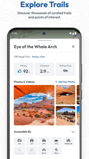
- Trail information supports planning for hiking
- cycling
- and off-road trips.
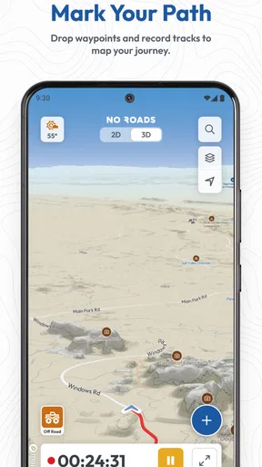
- GPS tracking lets users monitor routes and avoid losing their way.
- Useful map layers make terrain and remote roads easier to identify.
- Can help discover less-traveled routes away from crowded tourist areas.
Cons
- Coverage and trail accuracy may vary significantly by region.
- Some advanced map features may require a paid subscription.
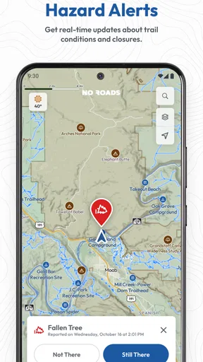
- Remote route data can become outdated as roads and trails change.
- GPS use during long trips can drain the phone battery quickly.
- Offline maps require storage space and must be downloaded in advance.
FAQs for No Roads: Off Road Maps
What is No Roads: Off Road Maps used for?
No Roads: Off Road Maps is designed for exploring trails, remote roads, and off-road areas where standard navigation apps may be less useful. It can help users plan outdoor trips, view routes away from major highways, and navigate through less-developed locations. It is particularly relevant for off-road drivers, hikers, campers, cyclists, and travelers who need mapping information beyond ordinary city navigation.
Does No Roads: Off Road Maps work without an internet connection?
Offline availability depends on the map areas and features supported by the app version you install. In general, an off-road navigation app is most useful when maps can be prepared before leaving mobile coverage. Users should download or cache the required regions in advance, verify that the data is available offline, and remember that GPS positioning may still work without internet, while live updates and online services may not.
Is No Roads: Off Road Maps suitable for hiking and driving?
The app can be useful for several outdoor activities, including off-road driving, hiking, camping, cycling, and route exploration. However, the best experience depends on the quality of mapping data for your destination. Drivers should check road conditions and vehicle restrictions, while hikers should confirm whether trails are official and suitable for their ability. It should support trip planning, not replace careful preparation.
Can I rely on No Roads: Off Road Maps as my only navigation tool?
It is safer to treat No Roads: Off Road Maps as a helpful navigation aid rather than your only source of direction. Remote routes can change because of weather, construction, private access, flooding, or inaccurate map information. Before traveling, review the route, carry a backup map or downloaded data, keep your phone charged, and tell someone about your plans. In isolated areas, basic navigation and emergency preparation remain essential.
What should I check before downloading No Roads: Off Road Maps?
Before downloading, check the app’s current store listing for device compatibility, required permissions, supported regions, pricing, subscriptions, and recent user feedback. It is also worth confirming how frequently maps are updated and whether offline maps, route recording, search, or navigation guidance require payment. Because off-road coverage varies considerably by location, verify that the destinations and trails you intend to visit are actually included.


